The Colorado Coalfield War Archaeological Project
Digital Atlas
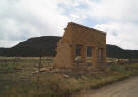
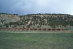
This digital atlas is a compilation of the historic and archaeological research conducted by the Colorado Coalfield War Archaeological Project. We present historical documents, oral histories, and the results of archaeological excavations to show how people living in Colorado's southern coalfields from 1890-1930 used space and the landscape. The atlas is divided into three basic areas, the pre strike period (1890-1912), the strike period (1913-1914), and the post strike period (1915-1930). You can access each of these periods through the links on the left-hand column. Within these areas there is a second division between historical evidence and archaeological evidence.
After choosing either history or archaeology, you will be linked to a base map. This base map contains buttons that when clicked open new pages with descriptions, maps, photographs or artifact counts. These windows give specific details of the landscape. Buttons are found in the base maps and at the bottom right hand corner of images. Below is a key for the different buttons detailing the type of data they provide.

The atlas is not mean to be a final interpretation of the events related to the Colorado Coalfield War of 1913-1914 . If you are interested in further information, we would suggest looking at the histories listed in the bibliography in the Project page.
Finally, to return to the home page, click on the logo found in the top-left corner ![]() . Thank you for your interest and please feel free to provide any comments or questions by clicking on the contact us link.
. Thank you for your interest and please feel free to provide any comments or questions by clicking on the contact us link.
Date Created 03/31/2006
Date Revised
04/04/2006