The Colorado Coalfield War Archaeological Project
Digital Atlas
National Guard Map
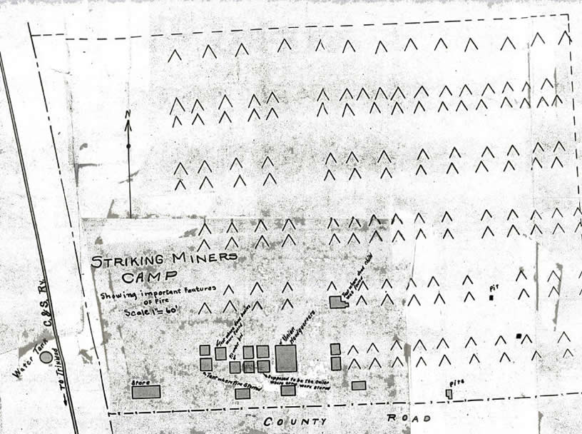
The National Guard produced this map of the Ludlow colony following the Ludlow Massacre. The National Guard noted the locations of specific events such as the suffocation of strikers' family members in a tent cellar and the placement of rifle pits. National Guard members claimed that strikers excavated rifle pits in the strikers' colonies. They claimed that strikers used these pits to violently defend the strikers' colony and to trap National Guard troops in the colony. Strikers did not mention any rifle pits, putting the existence of such pits into question. The positions of tents in this map are questionable as most of the tents were marked with little concern to their actual placement.
|