The Colorado Coalfield War Archaeological Project
Digital Atlas
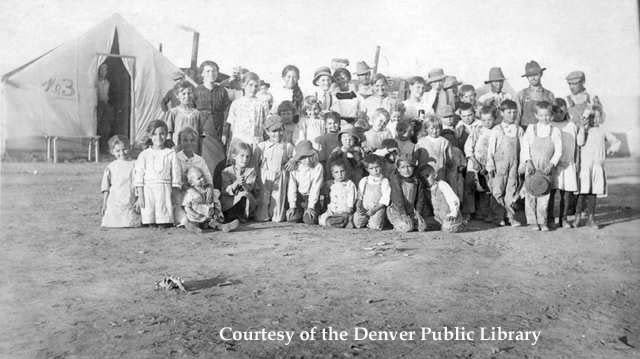
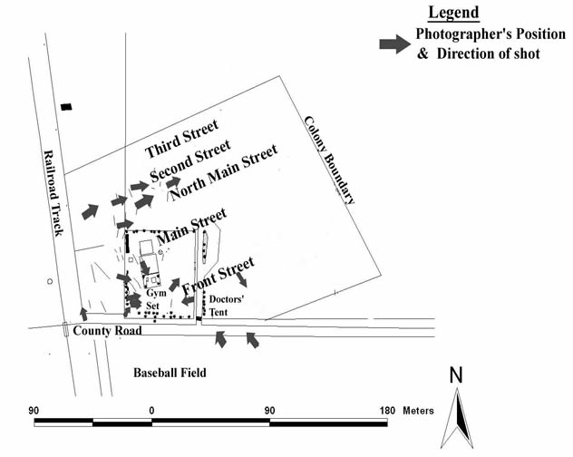
Photographic Overlay In using images with details on specific locations, as with the one pictured below, we as archaeologists can develop an understanding of the layout and organization of the colony. By overlaying historic photographs over the modern landscape we were able to identify where the photographer was standing when he or she was taking the photograph. With this information and descriptions included with the photographs from captions, we can identify features and the locations of streets. The map below shows how the location of photographers corresponds to the streets and layout of the Ludlow strikers' colony.
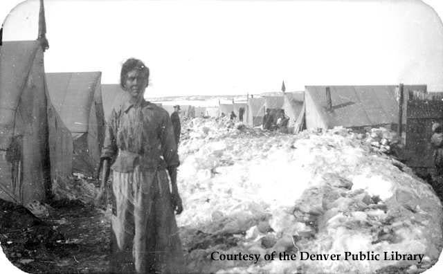
Woman on North Main Street Some of the strikers' tents had markings, including numbers (below), used to identify the tents. This numbering system is identified but not detailed by strikers and their families in historical documents. By identifying the location of certain numbered tents and streets in the colony, we as archaeologists can identify the presence of a spatially ordered layout for the Ludlow strikers' colony as well as the basic system for this organization.
|
| It becomes evident that the layout of the colony was not strictly aligned with either the railroad line or the county road that went by the colony. Instead, colonists oriented the colony 45-degrees off of these landmarks. |