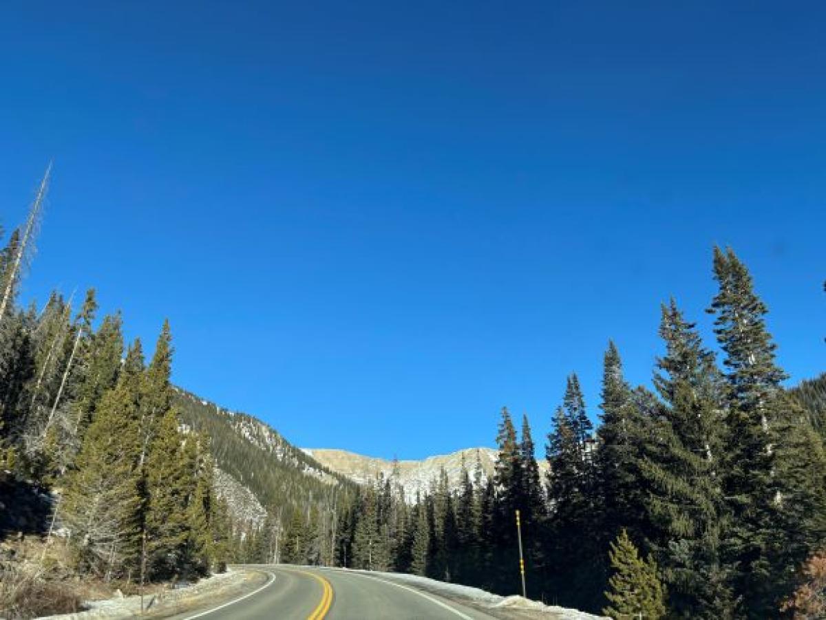
Anyone who has recently driven on Interstate 70 through the Rocky Mountains knows that the view looks strikingly different this winter. The typically snowcapped mountains have little to no snow. And the snow levels at Colorado’s many winter resorts are far below normal, with many trails still closed—leaving people who love to ski or snowboard out of luck. As of early February, the state’s snowpack is about 52% of the median, and it would take an estimated 5 to 8 feet of snow in the mountains to break even. This has left many residents with a series of lingering questions about the weather. Let’s take them one by one.
What is snowpack?
Snowpack is an accumulation of snow in the mountains. It acts as a natural reservoir to store water. As it melts, it fills the Colorado River and other major rivers—and then that water is captured in reservoirs such as Lake Dillion. Snowpack is crucial to our water system, climate regulation, and ecosystem. Right now, Colorado’s snowpack is the worst on record. While snowpack data goes back only to 1987, what we’re experiencing is still alarming and unusual.
Why is it so warm this winter?
In Colorado, December 2025 was the warmest December on record. For reference, it was 8.9 degrees F warmer than the 30-year average from 1991 to 2020. Climate change is certainly causing rising temperatures, but it alone doesn’t explain this outlier. Michael Kerwin, director of the University of Denver’s Environmental Science Program and an associate professor in the College of Natural Sciences and Mathematics, says a mix of things are causing the state’s lack of snow and warm temperatures: atmospheric rivers, persistent high pressure blocking storms, and a weak La Niña pattern.
“California has had some vigorous atmospheric rivers recently, which bring heavy precipitation and above-average temperatures,” Kerwin says. “Most of the impact of these narrow bands of subtropical water vapor are restricted to California. But some of that energy can leak into Colorado, providing a little added winter warmth.”
This season, a weak La Niña pattern is creating a persistent ridge of high pressure that has been farther east than normal, keeping storms out of Colorado. Normally, a La Niña ridge brings northern mountain snow. Because we aren’t seeing as much snow, the ground temperature is warmer than usual.
“The lack of snowpack can also impact winter temperatures. If there’s snow on the ground, as you’d normally expect, then some incoming solar radiation will either reflect back to space or be utilized to melt some of the snow. This year, without much snow, a higher percentage of incoming solar radiation is absorbed at the surface and re-emitted as long wave radiation, which we feel as heat,” Kerwin says.
How will low snowpack affect us in the spring and summer?
Snowpack is crucial to our water system. For example, Denver Water depends on mountain snowpack for 90% of its water supply. The water utility serves more than 1.5 million people in the Denver metro area.
“Colorado is potentially in a dire situation,” Kerwin says. “If this continues, we’re going to be looking at mandatory, strict water restrictions this summer in Denver, similar to what we had in 2002.”
While it’s unlikely that we’ll “make up” for lost snowpack and return to normal levels, there’s still a chance for more snow. Colorado typically gets 18% of its snow in February and 16% in March.
“People were talking about a great deal of hope with the current La Niña breaking down. And it is breaking down,” Kerwin says. “It’s shifting toward neutral conditions as we speak. And it seems to be building into an El Niño by April, May, or June.”
If we are left with an all-time low snowpack, Kerwin says the situation should serve as a wake-up call for how the West manages its increasingly strained water supply.
“We need to find ways to not use water the way we’ve been using water,” he says. “The United States, especially the Western states, use more water than anyone else on earth. We need to do better. Water is a finite resource.”
Is this the new normal?
Kerwin doesn't see this winter as the new normal—but it may be an indication of more volatility to come.
“I believe this is a type of new normal. Certainly, moving forward, we could have these warm and dry winters, but we could just as easily have cold, wet winters, too. It will depend on the position of the jet stream and the intensity of El Nino Southern Oscillation variability, both of which will be impacted by continued and future ocean heating,” Kerwin says.
For him, the bigger concern is complacency.
“It’d be wonderful if our community, leaders, and politicians thought about solutions during times of plenty,” he says. “But that’s not what our research on drought shows us. People forget about a crisis when it’s in the past.”
Even so, he hopes people don’t lose heart. The challenge, he says, is to remain engaged, continuing to plan and conserve even when wetter winters return and the urgency fades.